By Nancy Tutko
 Fifty years ago, much of the Vineyard was open to ramblers. Miles of dirt roads and paths, winding trails through woodlands and alongside pastures, and long stretches of beach—privately owned as well as public—were generally accessible, at least tacitly. As the Island became better known as a summer destination and the demand for housing increased, however, hundreds of acres were subdivided and built up. Some longtime byways were closed to the public.
In the face of strong development pressure, the land conservation movement on Martha’s Vineyard got a big boost in 1986 with the establishment of the Martha’s Vineyard Land Bank Commission. The Land Bank, funded by a 2% tax on most real estate transactions, joined Island towns and nonprofit conservation groups in the shared mission to protect and preserve open space for public benefit.
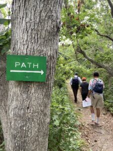
Photo by Katherine Hall
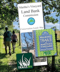
A network of trails began to take shape across the Vineyard landscape. But finding those trails wasn’t always easy. While some properties were mapped, there wasn’t a single map or guide that included all of them until 1990, when the Land Bank published the first comprehensive map of Island conservation lands.
“The commission hoped to encourage people to enjoy nature and to show voters a record of how the Land Bank fee was being spent,” said the Land Bank’s Executive Director, James Lengyel. That map included the commission’s first 728 acres, along with the Island’s other conserved properties. Over the years, public interest in the Land Bank map resulted in multiple printings, 10,000 at a time. “The map took on a life of its own. We underestimated how many people wanted them,” said Lengyel.
In 1996, Will Flender published Walking Trails of Martha’s Vineyard, a pocket-sized guide of conservation properties that became an immediate bestseller. Flender, who at the time was an intern at the Vineyard Conservation Society (VCS), gathered the data for his maps by rolling a surveyor’s wheel along the trails. For the first two editions, he drew maps by hand, traced and scanned assessors’ maps and land bank management plan maps, and pieced them together himself. By 2003, when cartographer Chris Seidel joined the Martha’s Vineyard Commission (MVC), Flender was ready to go digital. He worked with Seidel and MVC planner Bill Veno, who also does trail planning for the Land Bank.
“Chris gave me a Garmin GPS unit that I attached to my mountain bike,” Flender said. “I’d stop at every intersection and drop a data point, then continue on. I rode a lot of the Island’s trails that way. Chris downloaded the data I gathered and used it to create the maps.”
Seidel came to the MVC with a background in terrestrial ecology and geography. She began using ArcGIS—a digital mapping software—in grad school, then worked in engineering and surveying before moving to Martha’s Vineyard. Her geospatial mapping skills have helped facilitate coordinated land planning, and some of the data still in use today is a result of Flender’s efforts.
“Thankfully Will was willing to go out with the GPS unit to get all the trail data himself,” Seidel said. “It was a win-win. The centralized trail data that he compiled benefited the MV Commission, the towns, and all the conservation groups.”
Seidel, who oversees the ArcGIS data for all three Island trail-mapping tools—the Martha’s Vineyard Land Bank map, the Walking Trails book, and the TrailsMV app—said they complement each other. “People love a paper map—they can fold it, make notes on it, put it in their pocket. The impressive thing about Will’s book is the thought that went into the structure of it. It gives a nice overview of all the conservation properties; everybody loves it. And with the TrailsMV app, it’s easier to see where you are and how all the trails connect,” she said. “Together, they help the public see how much land is conserved and how it benefits them.”
In 2017, Sheriff’s Meadow Foundation (SMF) embarked on an ambitious project with Kate Warner of West Tisbury to create a mobile app that people could carry with them as they explored Martha’s Vineyard. Warner, the TrailsMV project manager from 2017 to 2020, played a key role in putting the Island’s thousands of protected acres and miles of trails into context.
“Through her belief in the vision for a single, practical, and beautiful trail app for the entire Island, and through her dogged determination, Kate saw the app through to its tremendously successful public launch,” SMF president Adam Moore said, noting that Warner walked all 220 miles of Island trails, documenting them for the first TrailsMV app and subsequent updates.
This fall, the Martha’s Vineyard Land Bank will print an updated version of its paper map, featuring 4,037 acres of its own acquisitions and nearly 17,000 other protected acres across Martha’s Vineyard. Flender, now a real estate lawyer in Burlington, Vermont, plans this winter to update Walking Trails of Martha’s Vineyard, published by VCS. And SMF’s new TrailsMV mobile app—recently redesigned using ArcGIS (see related article)—will continue to evolve as the Island’s trail system grows.
“The Land Bank is working toward a north-south, east-west, coast-to-coast network that will unite the Vineyard’s ‘green archipelago,’” said Lengyel, who is collaborating with the six Vineyard towns and nonprofit conservation groups. Bill Veno noted that today’s trail achievements have deep historic roots, built on the decades-long efforts of town boards and committees and organizations like VCS, protecting the public’s right to use ancient ways.
Over the years, the Land Bank map and Walking Trails book have played an important role in generating public support for land conservation, inspiring people to explore and learn about the rich diversity of conservation lands and their value to the community at large. TrailsMV’s digital technology adds a new dimension to these longtime favorite maps.
“TrailsMV helps give people the confidence to navigate the Island’s growing network of trails safely because they can see where they are along the way,” said Moore. “By keeping the trails map up to date and accurate in real time, it’s like having a knowledgeable hiking companion as a guide. It opens a new realm of opportunities for people who love the Vineyard’s undeveloped, natural places.”
Nancy Tutko is project manager for TrailsMV and has been exploring the backwoods and byways of Martha’s Vineyard for 30+ years.