


Discover new features of TrailsMV! The TrailsMV App has moved to a new platform. SMF partnered with ESRI who provided the necessary technical skills to support the transition. Come see the updated look for yourself!
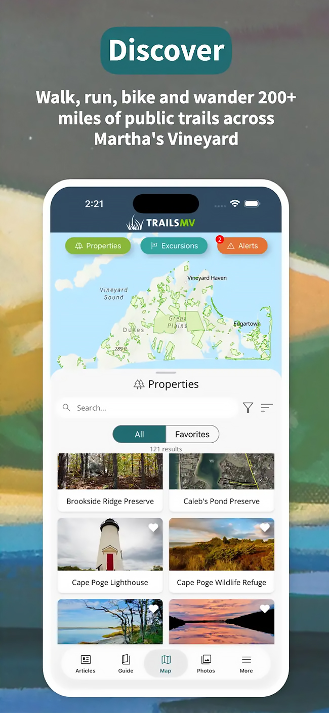
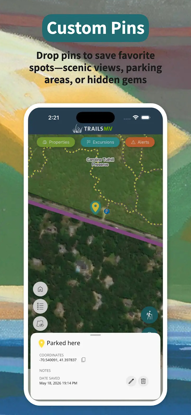
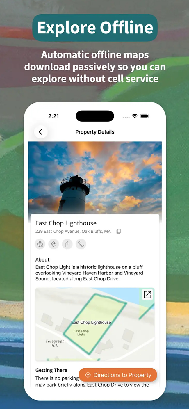
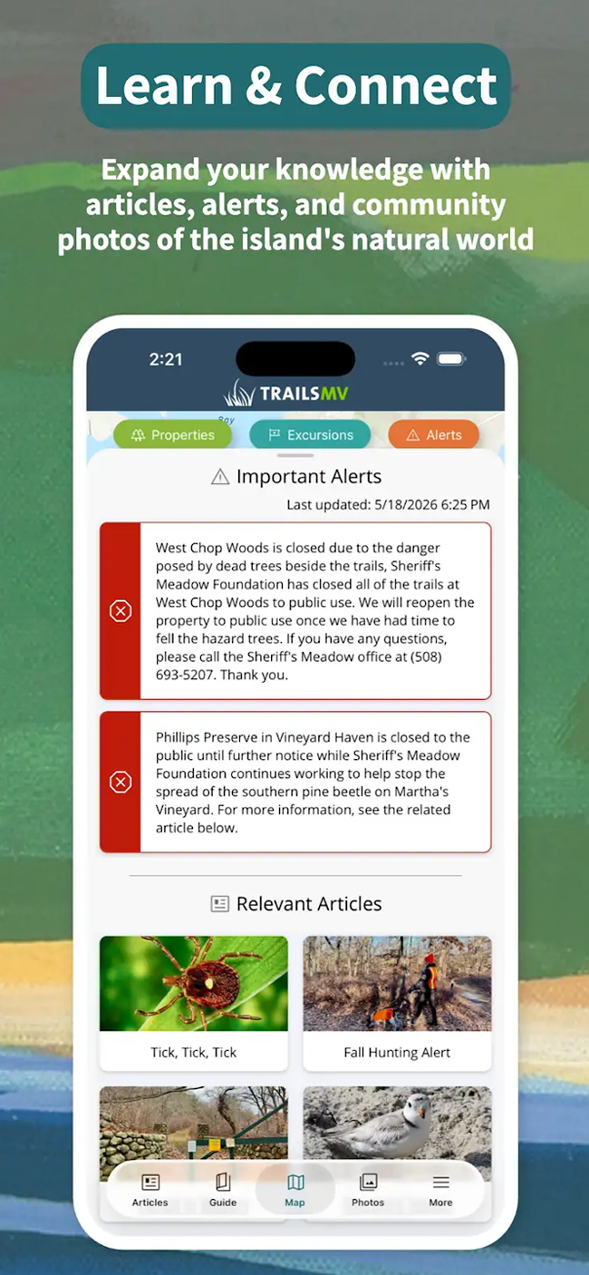
The free TrailsMV app, created by Sheriff s Meadow Foundation in collaboration with our conservation partners, is an interactive guide to 220+ miles of public trails on more than 100 protected properties.
APP FEATURES

TrailsMV is made possible through the vision, financial support, and collaboration of individual donors, the island’s conservation organizations, the Martha’s Vineyard Commission, the six island towns, Dukes County, Blue Raster, Esri, and our volunteer photographers. We are grateful to Cape Cod 5, Edey Foundation, Farm Neck Foundation, Martha’s Vineyard Bank Charitable Foundation, and Martha’s Vineyard Community Foundation, for helping underwrite the new TrailsMV.
Download TrailsMV today and explore Martha’s Vineyard with confidence!